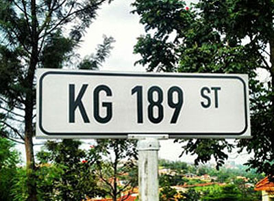
Editor,Please allow me to share my comments on the story, “Visitors still find Kigali streets difficult to navigate”, published in the Sunday Times on October 20.


Editor,Please allow me to share my comments on the story, "Visitors still find Kigali streets difficult to navigate”, published in the Sunday Times on October 20.The whole thing can be summarised into this question: Is there anybody who knows the method used to come up with the numbering system which was used?I know that KG stands for Kigali-Gasabo, but I haven’t been able to figure out how the numbers work. Do they start in the north and go south? Are even numbers east west streets and odd numbers north south? Is there any attempt to give roads close to each other numbers that are close?Seems like smaller numbers might be bigger streets? Knowing the logical numbering system that was employed (or having such a system?) would help a lot –otherwise it’s unnecessarily confusing.Curious, Kigali, Rwanda***************************Personally, I find the system easy whether using names (such as Village Urugwiro Road, Kigali City Tower Boulevard…) or simply letters (KG). At the end of the day, I think that it is all about being educated and being accustomed to it.For someone who doesn’t know the city, both systems will be complicated. For someone who is familiar with the city, it doesn’t matter much as I believe as soon as you say KG or KK, he already knows the destination. This is where education comes in – you should know that you’re in the districts of Nyarugenge, Kicukiro or Gasabo. By getting acquainted, everything becomes easy.Patrick, Kigali


